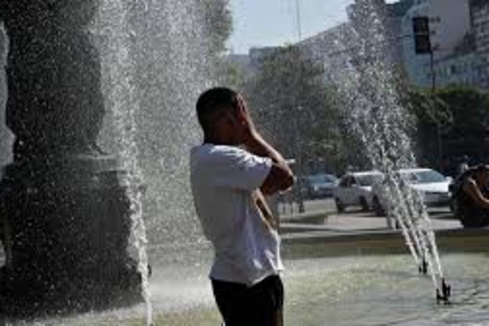
The temperature will rise up to 40 ºC (104 ºF), according to the agroclimatic report from the Buenos Aires Grain Exchange
Compartir:
In recent days, the weather in Córdoba has fluctuated between average and low temperatures.
Unlike other years, when November used to be an "oven," this year the heat still hasn't made itself strongly felt.
Nevertheless, the latest agrometeorological report from the Buenos Aires Grain Exchange forecasts for the coming days a large thermal amplitude and readings climbing up to 40 °C (104 °F).
Se viene una ola de calor en Córdoba.
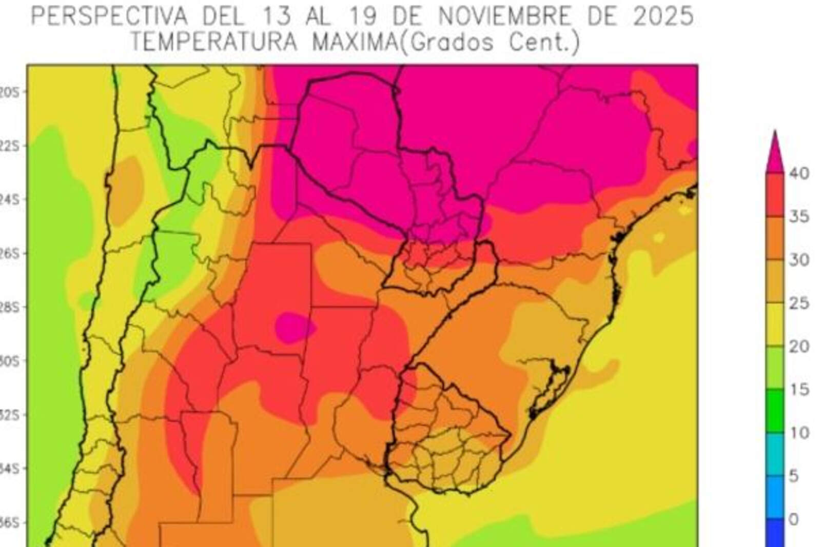
Tropical winds will produce above-normal temperatures in most of the agricultural area, with pockets of intense heat over its far north, reaching strongly into the east of NOA, the east of Cuyo, and the north of the Pampas Region, according to the report covering Thursday, November 13, to Wednesday, November 19.
"Only the Atlantic coastal strip will have readings within the normal range," it adds.
In northern Córdoba, maximums of up to 40 °C (104 °F) are expected, while in the center of the province they will range between 30 °C (86 °F) and 35 °C (95 °F).
Thermal amplitude in Córdoba
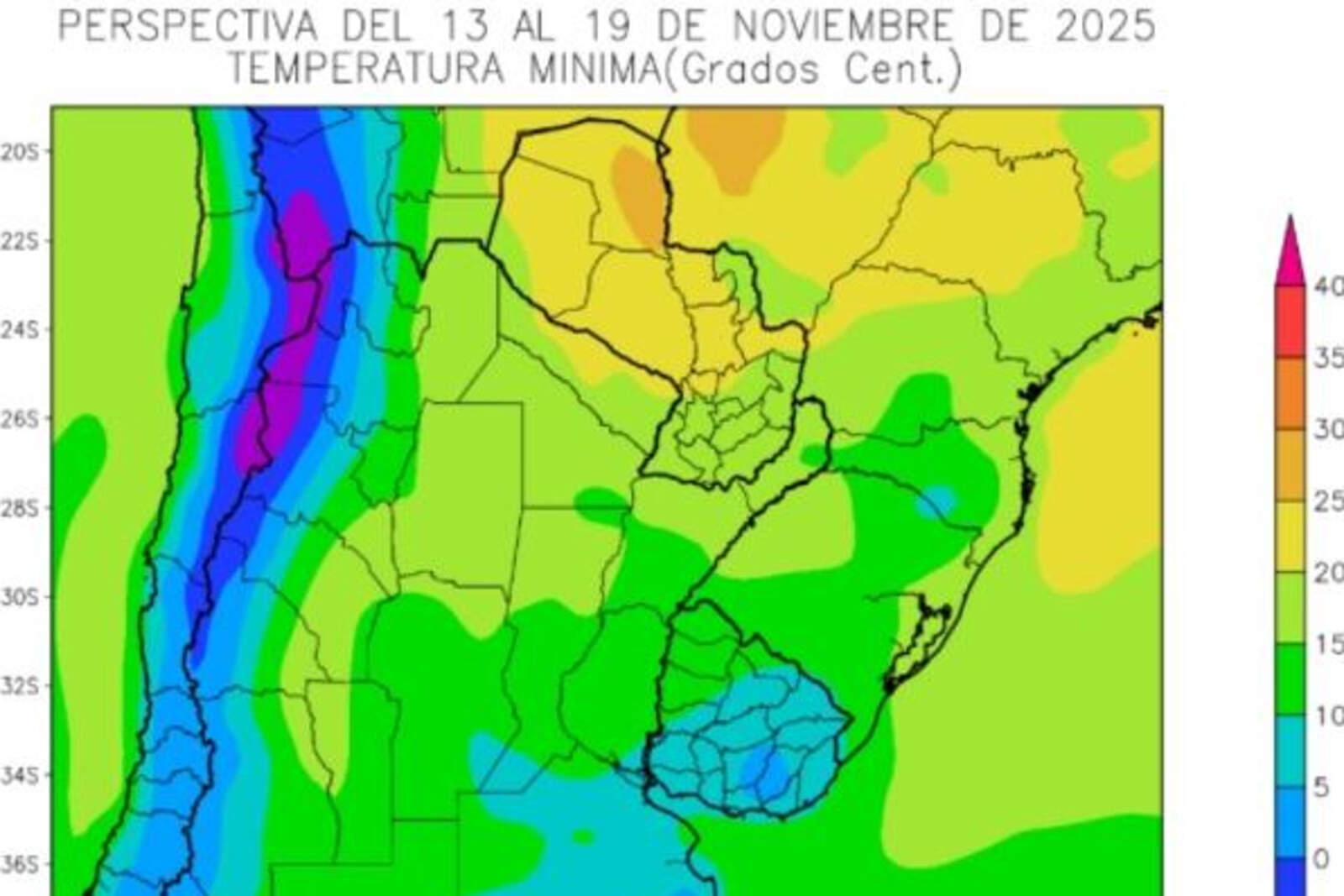
In Córdoba, minimum temperatures are expected to range from 10 °C (50 °F) to 15 °C (59 °F), with higher values toward the north. In the southeast of the province, minimums could reach as low as 5 °C (41 °F).
Las temperaturas mínimas de Córdoba.
Due to the entry of southern winds in previous days, the outlook will begin with below-normal temperatures in most of the agricultural area, with risk of localized and meteorological frosts over the mountainous and Andean areas of the West, according to the BCBA text.
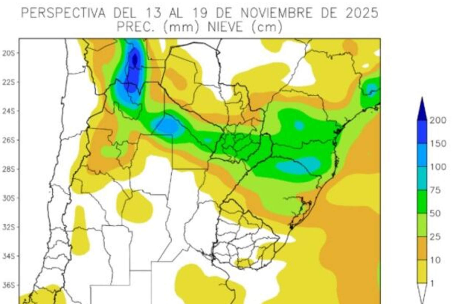
Rainfall in Córdoba
Toward the end of the outlook, a storm front will pass through, with highly variable activity, producing moderate to very abundant precipitation. This will have storm centers over the north of the agricultural area.
Se espera poca lluvia en Córdoba.
In Córdoba, little precipitation is expected, only in the northwest of the province (up to 10 millimeters).