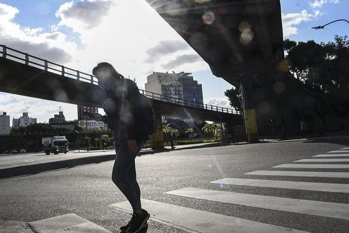
After one of the coldest mornings of the year, the AMBA begins this Tuesday, June 16 with a gradual improvement in temperature. However, the relief will be partial and the lows will remain below 10°C for much of the week.
According to the forecast from the National Meteorological Service (SMN), the coming days will be marked by the return of cloudiness and a low probability of rain towards Thursday. Meanwhile, the sun will regain prominence for much of this Tuesday.
The AMBA begins this Tuesday, June 16, with a gradual improvement in temperature
Today's weather: sunny Tuesday with pleasant afternoon
After the cold dawn, Tuesday shows much friendlier conditions than those recorded during the holiday. The sky is mostly clear and the north wind helps to moderate temperatures.
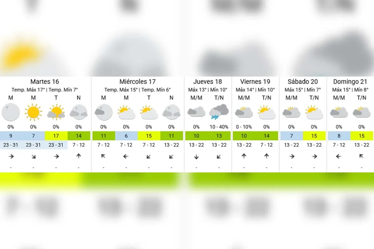
According to the SMN, the minimum was around 7°C, while the maximum will reach 17°C. It will be the warmest day of the week and a good opportunity to enjoy outdoor activities.
During the night, cloudiness will increase somewhat, although without the risk of precipitation.
Weather today: sunny Tuesday with a pleasant afternoon
Wednesday: clouds return to the porteño sky
Wednesday will mark the return of cloudiness over the City of Buenos Aires and the surrounding area. The morning will begin with a partly cloudy sky and a minimum temperature close to 6°C.
As the hours go by, cloud cover will increase. Still, no rain is expected and the maximum will hover around 15°C.
Wednesday: clouds return to the porteño sky
The presence of clouds will limit daytime warming, although the intense cold will be far from the records observed at the beginning of the week.
Thursday: the most unstable day of the week
Thursday appears to be the day to watch closely. Updated weather data shows a 10% to 40% probability of isolated rain during the afternoon and night.
The morning will start with abundant cloudiness and a minimum of 10°C. As instability progresses, some light precipitation could be recorded over different sectors of the metropolitan area.
Thursday: the most unstable day of the week
The temperature will have little thermal amplitude and will barely reach 13°C during the afternoon.
Friday with improvements in the weather and partial return of the sun
After the instability, Friday will show more stable conditions again. The sky will remain between partly and mostly cloudy, but the chances of rain will be very low.
Friday with improvements in the weather and partial return of the sun
The temperature will range between 10°C and 14°C, maintaining a cool environment but without extreme cold.
How the weather will be during the next weekend
Current projections anticipate a relatively stable weekend in the AMBA. Both Saturday and Sunday would present a partly cloudy sky and similar temperatures.
Saturday: minimum of 7°C and maximum of 15°C.
Sunday: minimum of 8°C and maximum of 15°C.
For now, no significant rain appears on the horizon and winter will continue to show cold mornings, but without new incursions of polar air in the coming days.
Extended forecast - SMN
A cold week, but far from extreme temperatures
The mass of cold, dry air that entered over the weekend continues to dominate the weather scenario. Thanks to this, humidity remains controlled and no significant fog episodes are expected.
The great news is that the icy dawn of Monday is behind us. Although mornings will continue to be cold, the thermometer will show more moderate values as Buenos Aires approaches the official start of astronomical winter.