Satellite images revealed the magnitude of the super typhoon In-fa and the advance of the remains of Champi towards Alaska, in a scenario that specialists relate to the development of the El Niño phenomenon
As reported by the US space agency, the season began with super typhoon Sinlaku, which hit Micronesia, Guam and the Northern Mariana Islands. Since then, another 25 named storms have developed and activity remained high until the end of October
.
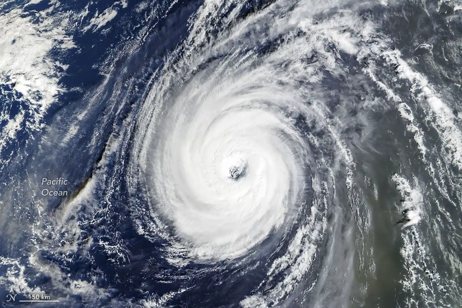
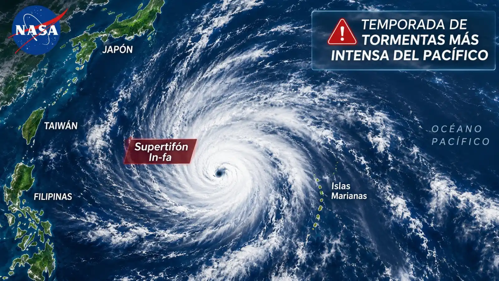
One of the most notable phenomena was the super typhoon In-fa, which moved close to the Mariana Islands and reached an exceptional intensity. On October 29, the EPIC camera, installed on the DSCOVR satellite, captured an image of the storm as it advanced across the Pacific.
The Pacific Ocean is where a large number of storms have developed in the last month
A day later, the MODIS instrument on NASA's Terra satellite obtained new images that allowed us to observe its almost circular structure and a
large eye.
At the same time, the remnants of Typhoon Champi were approaching Alaska, where they were integrated into a storm system that crossed the Bering Sea. Both phenomena reflect the complexity of a season that, according to specialists, has particularly active characteristics.
Why the super typhoon In-fa caught the attention of NASA scientists One of the
most striking features of In-fa was its structure, which meteorologists identified as similar to that of an annular storm, a rare type of tropical cyclone
.
Unlike conventional typhoons, which usually have extensive bands of spiral rain, these storms have a more compact and circular shape, with a wide eye and a relatively uniform distribution of the surrounding clouds.
By their appearance, specialists often compare them to a donut or a tire.
According to studies cited by NASA, annular storms represent approximately 4% of tropical cyclones in the Northwest Pacific.
The Mariana Islands are severely affected
In addition, their eyes usually reach an average diameter close to 45 kilometers, while in conventional tropical cyclones this measurement is around
25 kilometers.
Another peculiarity is that they can maintain their intensity for longer, even when weather conditions are no longer favorable for their development.
In the case of In-fa, its structure was especially visible in the images taken on October 30, when the phenomenon was located west of the Mariana Islands.
The typhoon became the fifth system of its kind to affect the archipelago during 2026, reflecting the persistence of cyclonic activity in the region.
What happened with Typhoon Champi and why its effects reached Alaska
It was Champi, a powerful typhoon that reached maximum sustained winds of close to 300 kilometers per hour during its journey through the Western Pacific.
The storm caused heavy rain and wind in areas of Guam, Taiwan, China and Japan. However, its trajectory did not end when it began to lose its tropical characteristics.
As it moved to higher latitudes, Champi underwent a process known as an extratropic transition, through which a tropical cyclone is transformed into a different weather system.
Tropical cyclone
Tropical cyclones derive their energy primarily from the heat and moisture of warm ocean waters. Instead, extratropic systems are powered by temperature contrasts between cold and warm air masses
.
This transformation can considerably modify the structure of a storm and expand the surface area affected by its winds.
“One of the distinguishing features of extratropic transitions is the expansion of the storm's wind field,” said Gary Partyka, meteorologist at NASA's Goddard Space Flight Center.
“It's not that the winds necessarily get stronger, but that they cover a much larger area,” he added.
In this case, the remains of Champi were incorporated into a storm system that was advancing over the Bering Sea and helped to intensify it.
“It seems that Champi was intertwined with that system and helped to intensify it,” Partyka said.
When the phenomenon reached the vicinity of Alaska, some regions experienced strong winds, heavy rain and snowfall.
Although there was no damage of the magnitude of that caused by the Halong typhoon in October 2025, the episode once again highlighted how a storm originating in tropical waters can influence the climate of territories located thousands of kilometers further north.
According to Rick Thoman, meteorologist and climatologist at the University of Alaska Fairbanks, Champi was the fourth extyphoon to reach waters near Alaska during 2026, after Bang-Lang, Dujuan and Choi-wan.
The specialist noted that, since 1970, approximately 60 such systems have affected the American state.
What is the relationship between El Niño and the intense storm season in the Pacific
Researchers are also analyzing the influence of the El Niño phenomenon, a climate pattern that modifies ocean temperatures and can alter atmospheric circulation in different regions of the planet
.
This phenomenon is characterized by a higher than average warming of surface waters in the equatorial Pacific and usually occurs at irregular intervals of between two and seven years.
Its effects can modify rainfall patterns, temperatures and winds, in addition to influencing the formation and trajectory of tropical cyclones.
In the Northwest Pacific, certain conditions associated with El Niño may favor storms moving north rather than moving west, toward the Asian continent.
This may increase the exposure of territories such as Guam, the Northern Mariana Islands, Japan and the Korean Peninsula to certain cyclone courses.
Partyka described 2026 as a particularly active year for tropical cyclones in this region and noted that the development of an intense El Niño episode could be contributing to that behavior.
On the other hand, increased tropical activity can also increase the chances that some systems will reach higher latitudes and become extratropic storms.
In this scenario, NASA satellite observations allow us to follow the evolution of cyclones and analyze how they interact with other weather systems.