Waves reached Japan, the U.S., and even Mexico, although no serious damage or casualties were reported.
Un sismo de magnitud 8,8 frente a la península de Kamchatka provocó alertas de tsunami
A historic earthquake in a volcanic region
The U.S. Geological Survey (USGS) confirmed that the epicenter was about 11 miles (18 kilometers) deep, on the ocean floor. The earthquake occurred shortly after 8 a.m. Japanese local time.
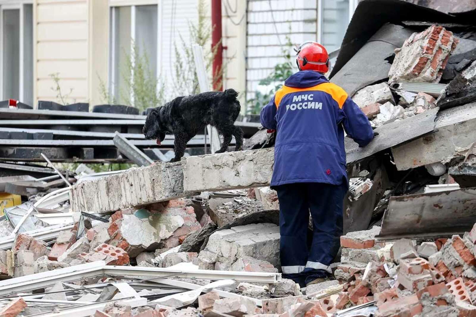
This is the most powerful seismic event in the region since 1952. Kamchatka, known for its volcanic activity, hadn't experienced anything like this in more than 70 years.
The striking images that circulated from Kamchatka
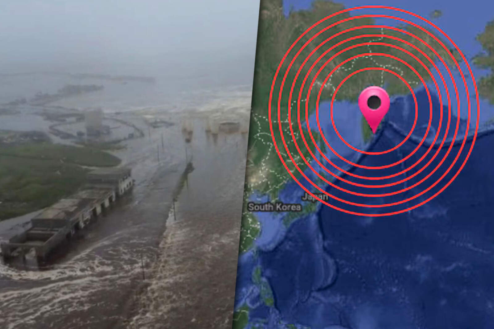
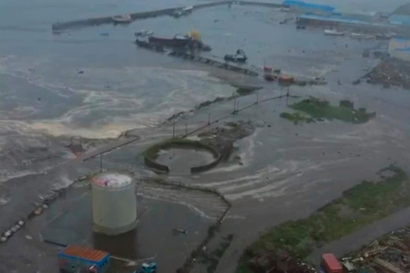
Videos shared on social media showed waves up to 13 feet (4 meters) hitting the southeast Russian coast. In Paramushir, one of the Kuril Islands, the water advanced up to 656 feet (200 meters) inland.
There was damage to ports and moments of tension, but no confirmed casualties so far.
Japan activated its coastal alert system
Although the impact was minor, Japan reacted immediately by activating its preventive protocol. In northern Hokkaido towns, the tremor was level 2 out of 7.
Las imágenes impactantes del tsunami
Waves less than 3 feet (1 meter) reached ports such as Kushiro, Hanasaki, and Nemuro. The images showed flooded docks and boats shaken by the currents.
U.S. and other countries remain on alert
The Pacific Tsunami Warning Center asked coastal communities to stay informed. Emergency sirens were activated in areas of the U.S. Pacific.
The first recorded waves were low in height, but the protocol remains active until further notice.
International alert: China, Taiwan, Mexico, and Central America
China issued warnings for waves up to 16 inches (40 cm) in Shanghai and Zhejiang. In the Philippines, an impact of less than 3 feet (1 meter) is expected.
Taiwan activated its second highest alert level, while Mexico and Central American countries deployed their protocols. The rapid response helped contain the risk.