The National Meteorological Service confirmed that several areas of the country will be affected by heavy rainfall
Nuevo
Agregar La Derecha Diario en
Compartir:
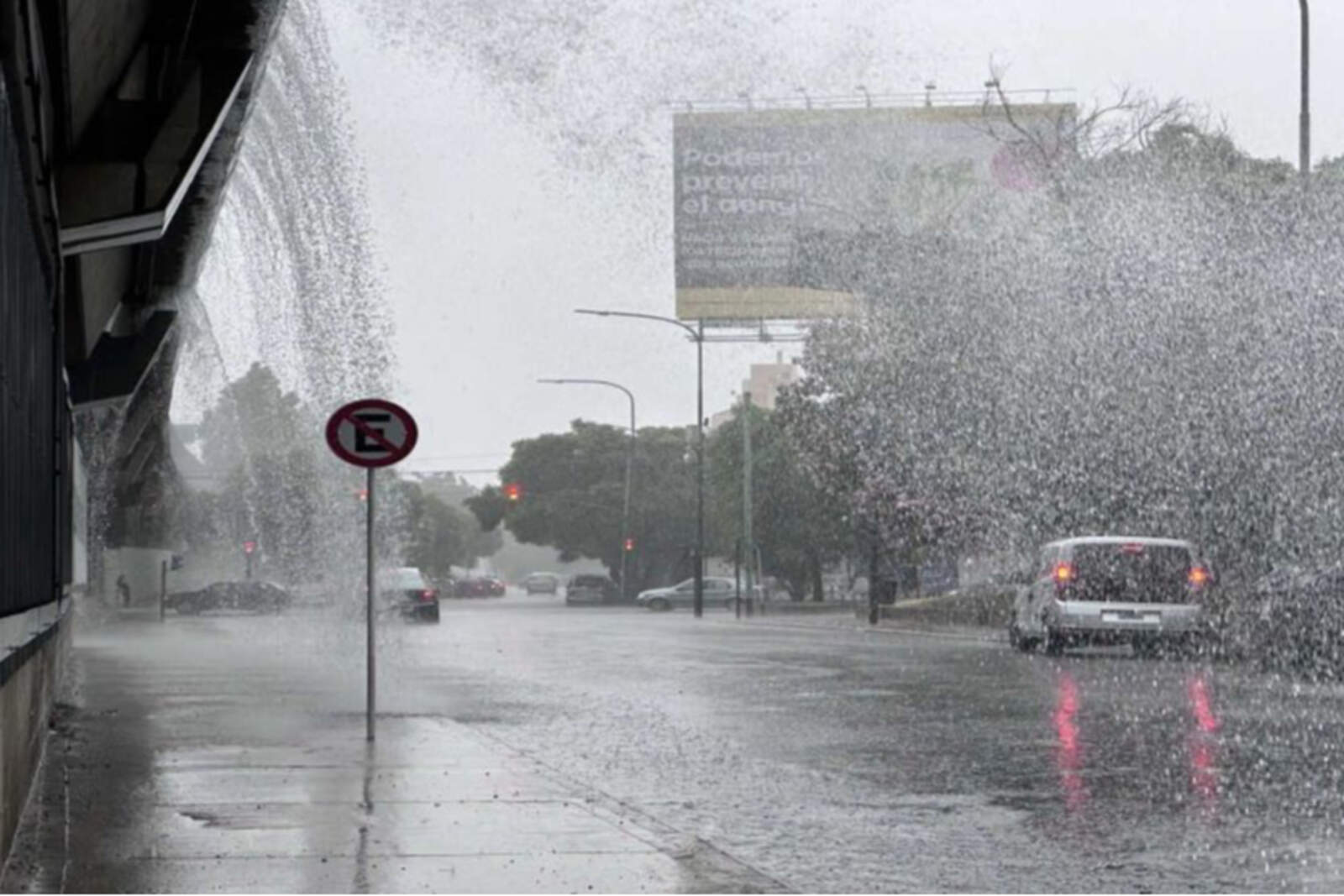
The weekend will arrive with instability in much of the country. According to the National Meteorological Service (SMN) in its update for this Saturday, December 6, seven provinces are under a yellow alert for storms, while some specific areas have also moved to an orange alert due to the expected intensity of the phenomena.
The provinces included in the yellow alert are as follows:
Tucumán
Catamarca
La Rioja
San Juan
San Luis
Mendoza
Buenos Aires (southern and central sectors)
According to the agency, the affected regions could experience storms of varying intensity, some locally strong, accompanied by hail, frequent electrical activity, abundant rainfall in short periods and gusts that could reach 70 km/h (43 mph).
Lluvias intensas en gran parte del territorio argentino
In these areas, rainfall accumulations between 20 and 40 mm (0.8 to 1.6 inches) are expected, although it is not ruled out that values may be higher in specific locations. In high mountain areas, especially in Cuyo, precipitation could occur as hail or snow, depending on the altitude.
Buenos Aires localities affected by the alert
Among the areas of Buenos Aires province under warning are: West of Castelli, West of Chascomús, West of Dolores, West of General Lavalle, West of Lezama, West of Punta Indio, West of Tordillo, Pila, Ayacucho, Balcarce, General Guido, and Maipú.
Also: Northwest of General Juan Madariaga, Northwest of Mar Chiquita, West of General Pueyrredón, Azul, Rauch, Tapalqué, low area of Benito Juárez, low area of Tandil, Brand Adolfo Gonzales Chaves, center of Lobería, north of Coronel Dorrego, north of Necochea, north of San Cayetano, north of Tres Arroyos, Pinamar, southeast of General Juan Madariaga, and Villa Gesell.
Orange alert in two provinces
In addition to the general warning, the SMN issued an orange alert for sectors of San Juan and a small region of La Rioja. There, strong or severe storms are expected, with very intense precipitation in short periods, larger hail, persistent electrical activity and gusts that could reach up to 90 km/h (56 mph).
The orange alertimplies a higher level of meteorological risk, with phenomena capable of generating significant impacts on daily life, such as flooding, material damage or complications in traffic.
In the presence of strong storms, the agency recommends the following points to keep in mind:
Do not take shelter under trees or light poles.
Avoid driving on flooded streets.
Remove objects that could be blown away from balconies or terraces.
Stay informed through the official SMN channels.
Keep flashlights and chargers handy in case of possible power outages.
Do not take out the trash to prevent streets from becoming blocked.